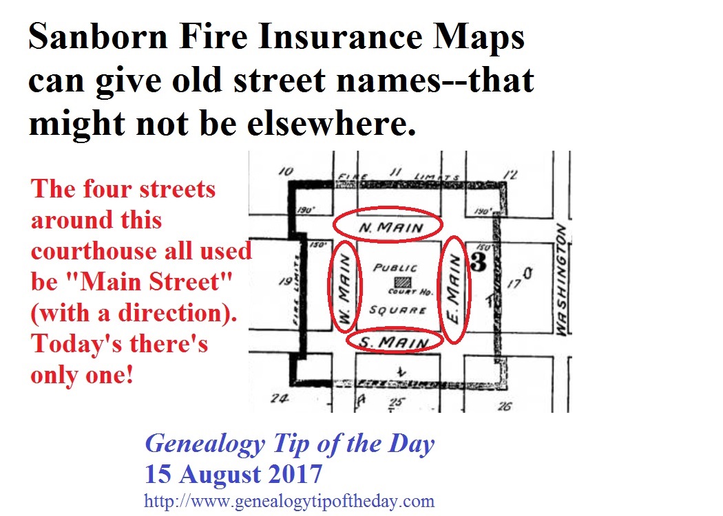
Researchers in need of former street names in the United States may wish to look at fire insurance maps. This 1893 map of the courthouse square in Carthage, Illinois, indicated that all four streets surrounding the courthouse were named “Main Street” (with a direction as a part of the name). Today the former “North Main Street” is Main Street. The others have been renamed. 
More information on the maps:
- Library of Congress
- Sanborn Maps for Pennsylvania
- search Google for “sanborn fire insurance maps” yourstate to find others.


2 Responses
Michael, I just tried looking at a couple of small towns Adams CT and got the message below. So then I went to 1893 Carthage and got the same message:
___________________________
CARLI Digital Collections
We’re sorry, as of May 21, 2017, CARLI is no longer able to provide off-campus authentication to the images in the Saskia Art Images and Sanborn Maps of Illinois (1867-1970) digital collections.
Access to these materials is available on-campus at CARLI Governing member institutions, or through their campus VPN or other IP proxy services offered by those institutions or libraries.
Return to CARLI Digital Collections
________________________________
I then did a search for Sanborn maps and found this site of to Library of Congress, Geography & Map Reading Room:
https://www.loc.gov/rr/geogmap/sanborn/city.php?CITY=Carthage&stateID=15
I looked at Carthage and several large and small cities and ALL URLs have “not available online”
I am assuming you got that image before May 2017. I am sure that I have looked at these maps in the past too , so something must have changed at least for IL. (I took a look at MO and thru Univ of MO I can see Hannibal.)
________________________________
I JUST FOUND HOPE — Newberry Library in Chicago:
https://www.newberry.org/sanborn-maps-color-coming-library-congress-soon
posted (orig maps are in color, but when putting on microfilm they went the least expensive route of Black/White) —
However, the Library of Congress has announced that it is digitizing in glorious original color their Sanborn map collection. They began last year and are working through the pre1900s maps first and at present have 3,483 maps digitized and available online. You can find this collection at the Library of Congress’sSanborn Map site. Thus far the state of Illinois has one (1) map online and it is of Tampico, Illinois but the Library of Congress promises more maps are coming.
__________________________
Donna (PS I give you permission to modify this post to shorten it).
Thanks for your comments. Yes, the image was pulled some time ago. And you are correct in your comments. These maps are all currently online and the LOC is working on putting them on their site.