Townships are spread throughout the United States and usually are responsible for a variety of civil functions. In areas where the rectangular survey system is used (generally settled after the Northwest Ordinance of 1787) there’s also a township referred to as a Congressional township. Congressional townships serve a different purpose.
Congressional Townships are used to determine where a piece of property is located and were used for original surveying purposes when property was being settled in the federal domain. In many places Congressional Townships and civil townships have contiguous boundaries. Congressional Townships are assigned numbers to describe their location in relationship to base lines and meridians. Civil townships usually have names.
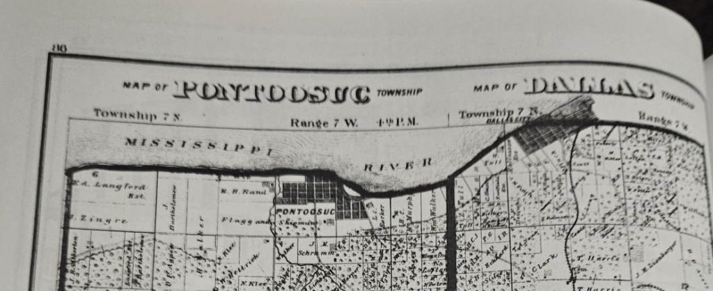
The illustration shows one Congressional Township in Hancock County, Illinois (Township 7 North Range 7 West). That township serves no civil government purpose. This Congressional Township is different from most as it is divided into two civil townships that provide various governmental functions: Pontoosuc and Dallas City townships.


No responses yet