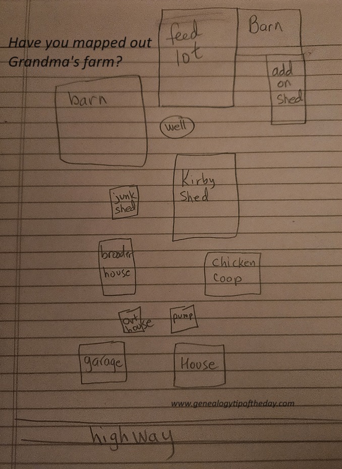
I’ve got all the buildings that were once there (I think), but my scale and positioning needs some work.
Genealogists should always be looking for maps, but are there maps that we could create ourselves? Several of the buildings on my Grandma’s farm are no longer standing. The garage and the original house are gone–replaced with a shed and a larger home. The map I’ve made needs some work, but the essentials are there.
It’s not just Grandma’s farm that could be drawn out or mapped. A map could be made of the rooms in the home you grew up in or what you remember of the interior of your Grandfather’s home. Digital images of actual pictures could be used to augment the map you have drawn.
The image shown is my rough sketch. A better approach would be to use a graphics program or app which would then allow me to move the buildings on my image to improve the scale and the relative position of things. But this is better than nothing–which is what I currently have.
Also remember to include who drew the map and the approximate time period. That matters as well.


No responses yet